
Marine Industry Scanning
The typical approach when performing ship checks is to bring designers and/or engineers on board where, using tape measures, they record measurements of the existing systems and spaces. These measurements are then used in developing scope and construction documents. However, the uncertainty of the measurements requires allowances be included to account for discrepancies between the measurements and reality. These allowances can be expensive and/or prevent the installation of new equipment in a certain location because the space was considered too small, when in fact there was adequate clearance. Or, conversely, maybe not enough at the time of installation.
A better approach involves scanning ship spaces with a 3D laser scanner to create a very detailed and accurate 3D point cloud model. Today’s high speed laser scanners are quite suitable for this purpose as they can take tens of millions of measurements in just a few minutes. Scans are taken from various positions in order to provide sufficient coverage around equipment. The scans are then registered together to bring them all into the same coordinate system. Scans of the ships hull and keel can also be taken, in which hull curves and surface models can be created for fuel or stability analysis if needed.
We also provide laser scanning services for ballast water treatment systems.
Laser scanning used to create an accurate surface model of the boat’s hull.
Scan points can be seen on both sides of the surface model. This implies an excellent fit with minimal deviation.
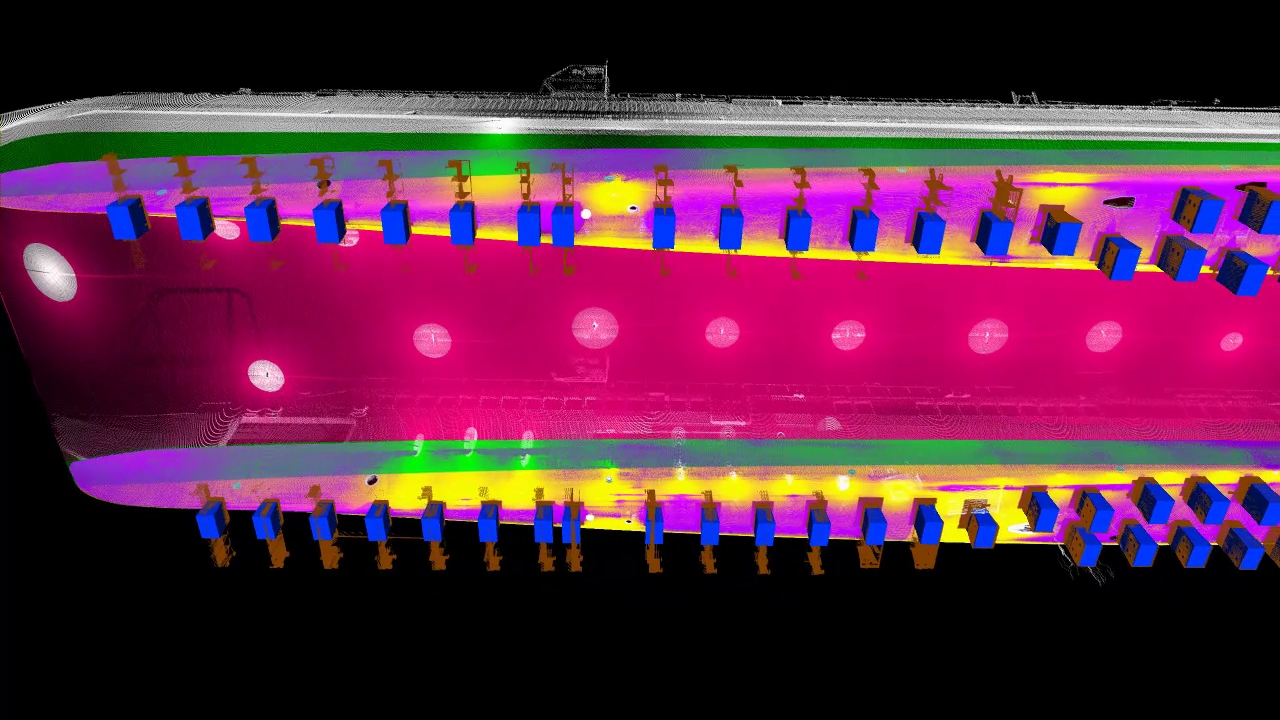
 Underside of hull and it's scan points
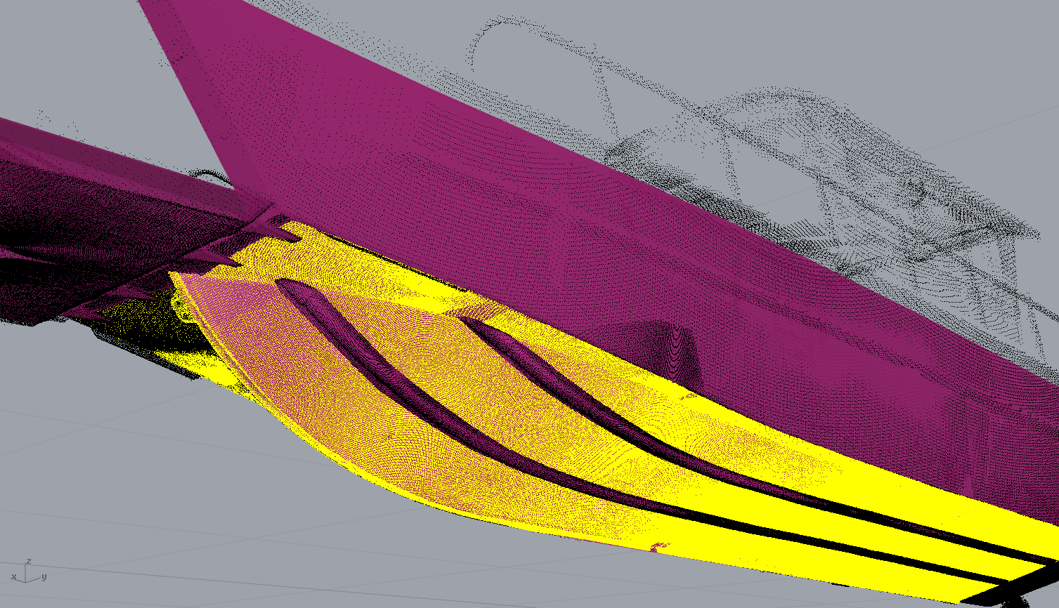
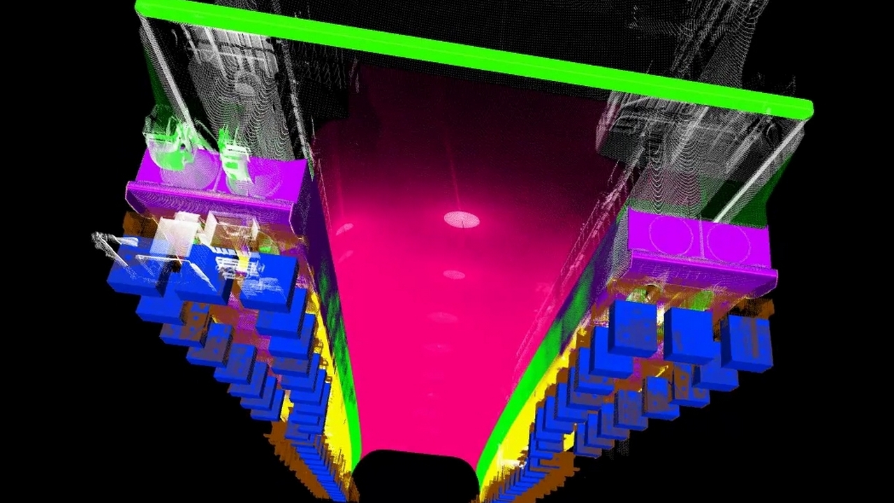
 Inside view displaying scan points against the surface model
 Scan points and modeled keel
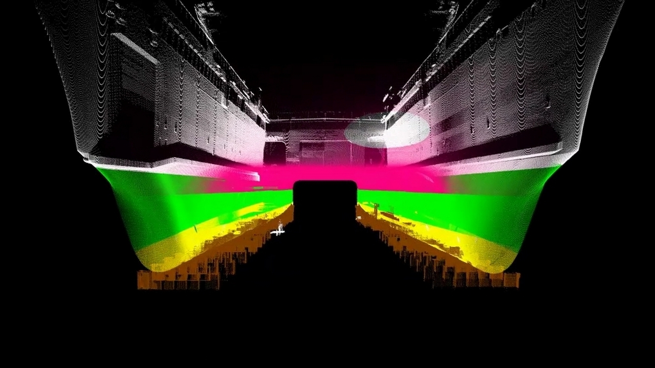
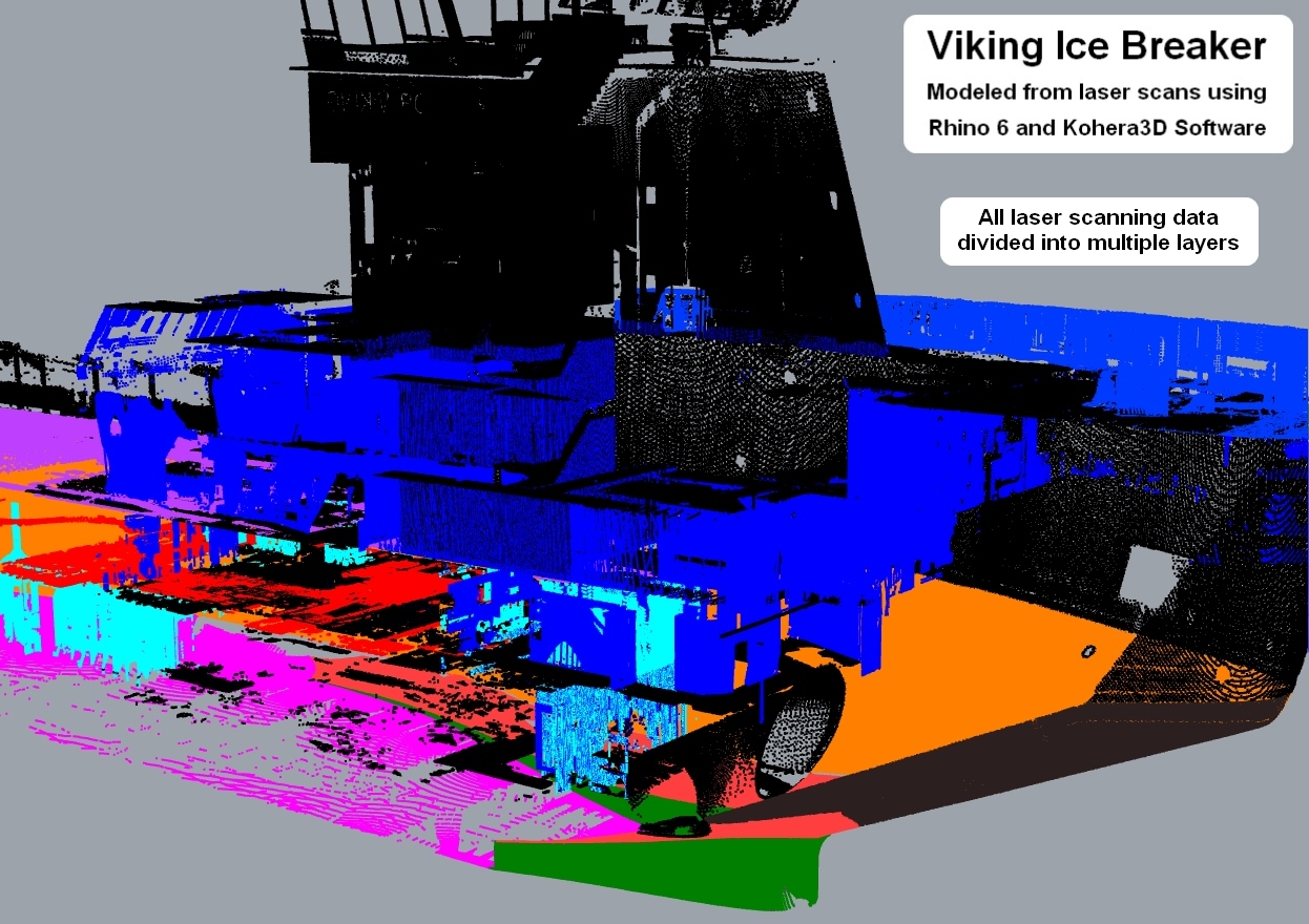
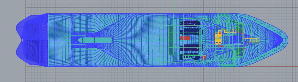
Here the point cloud was first isolated into layered groups as noted by their different colors.
Using laser scans as a reality reference, a docking plan was created by modeling the ship’s hull and dunnage.
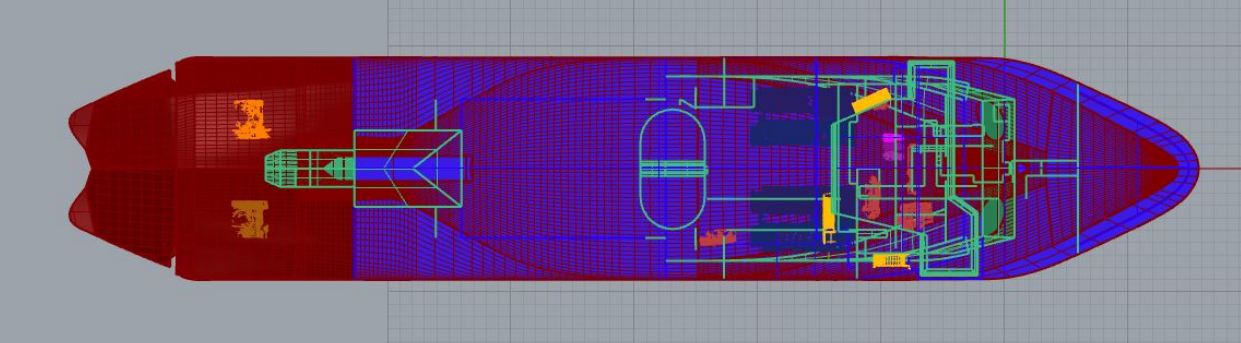
 Isolation of the hull and dunnage
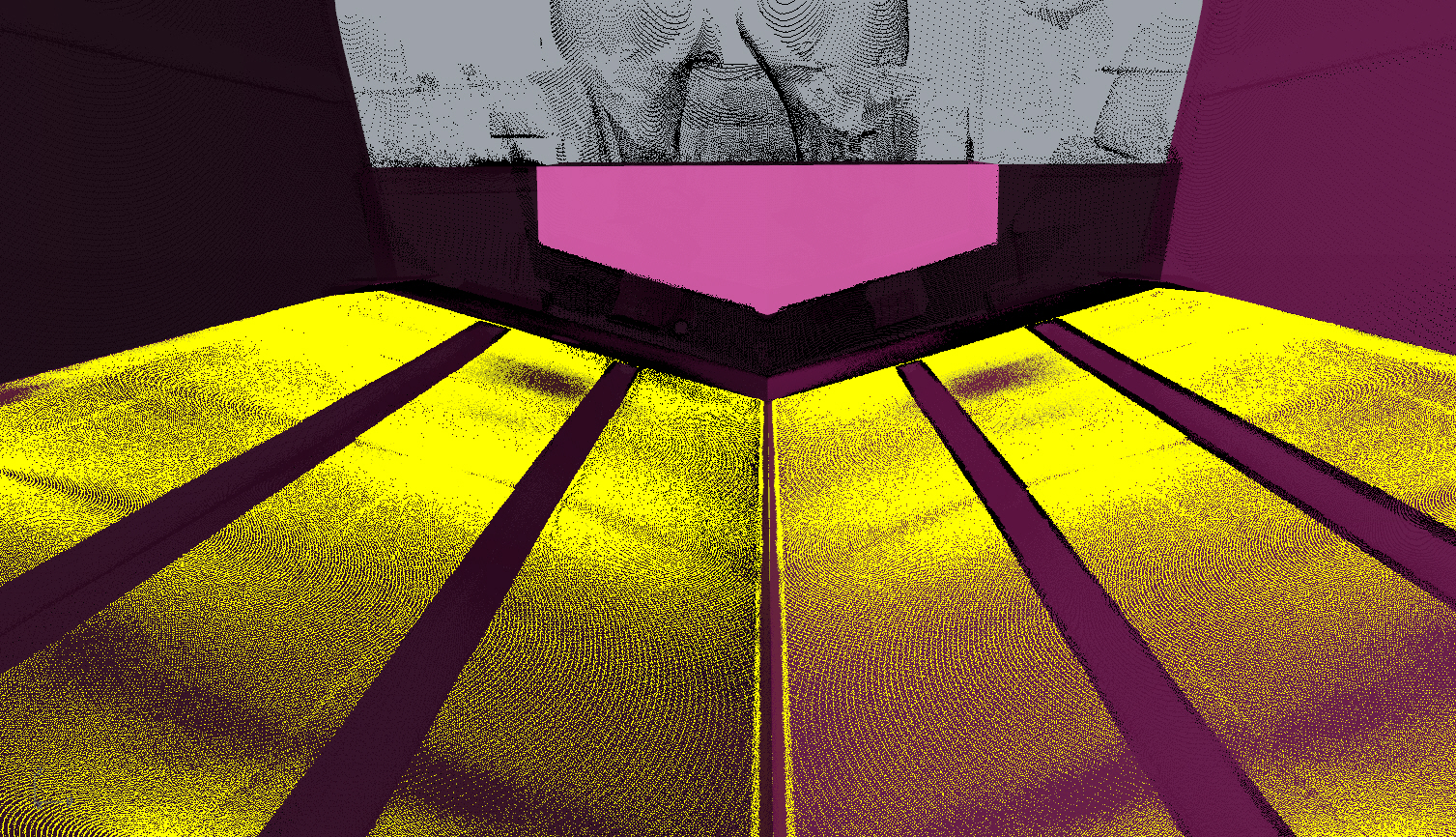
 Underside view of isolated scan points and surface model
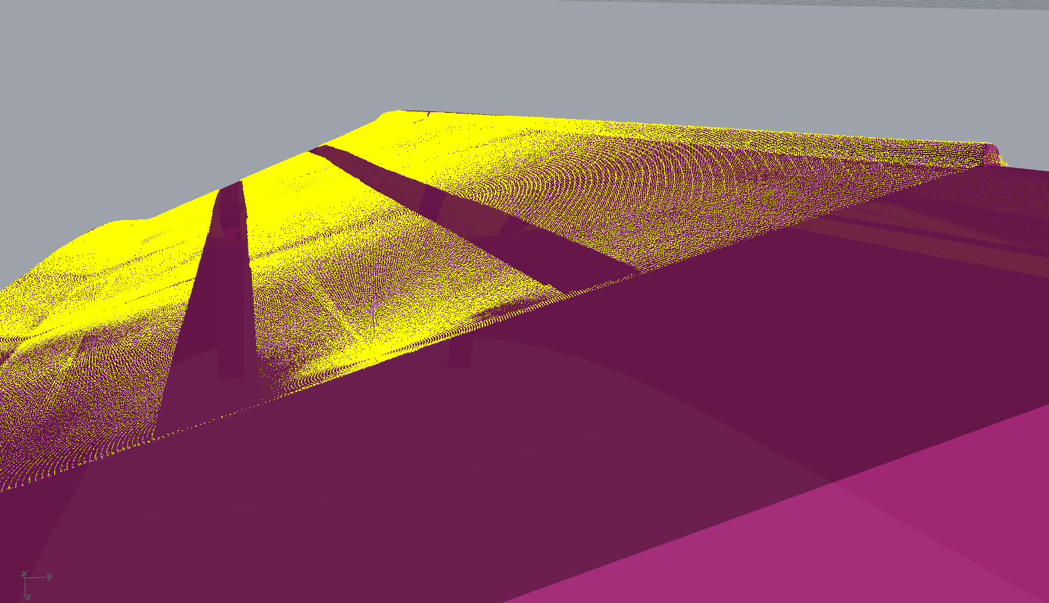
 View of the stern, scan points and the surface model
Viking Ice Breakers modeled using Rhino 6 and Kohera3D proprietary software.
Using in-house software (not released to the public), we isolate the scan data into separate layers and import the data into Rhino.
 Viewing our scan data isolations as layers in Rhino
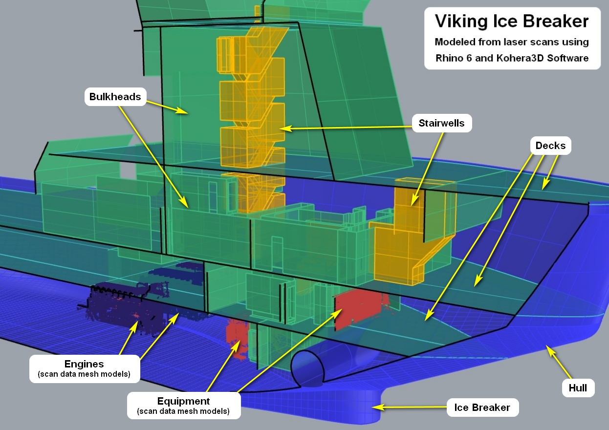 Modeling of the ship's hull and bulk heads
 Viking Ice Breaker 1
 Viking Ice Breaker 2