Laser Scanning Projects
Coos Bay Rail Line Bridge
Integrate advanced 3D laser scanning technology with Rainer Welding bridge building expertise to solve a complex bridge restoration project.
Related content
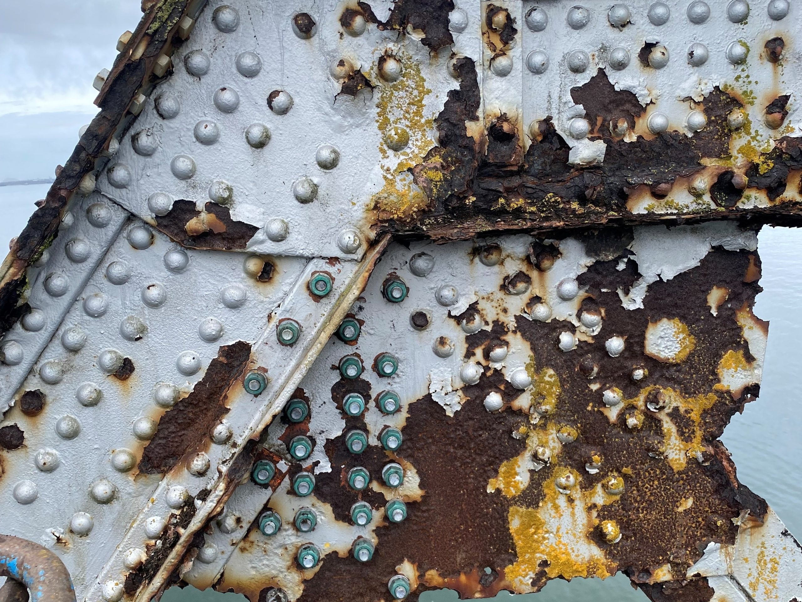 Existing conditions
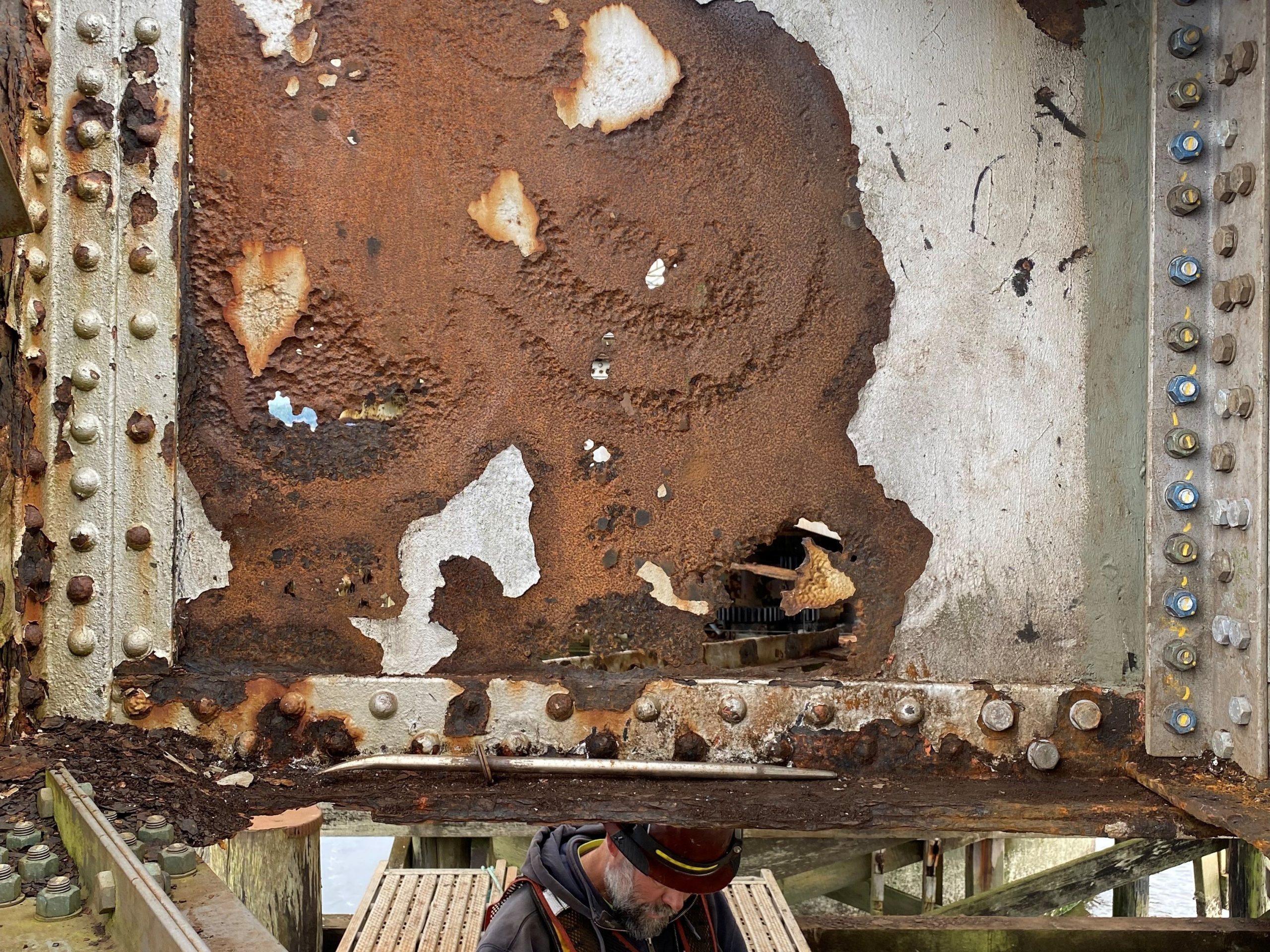 Existing floor beam
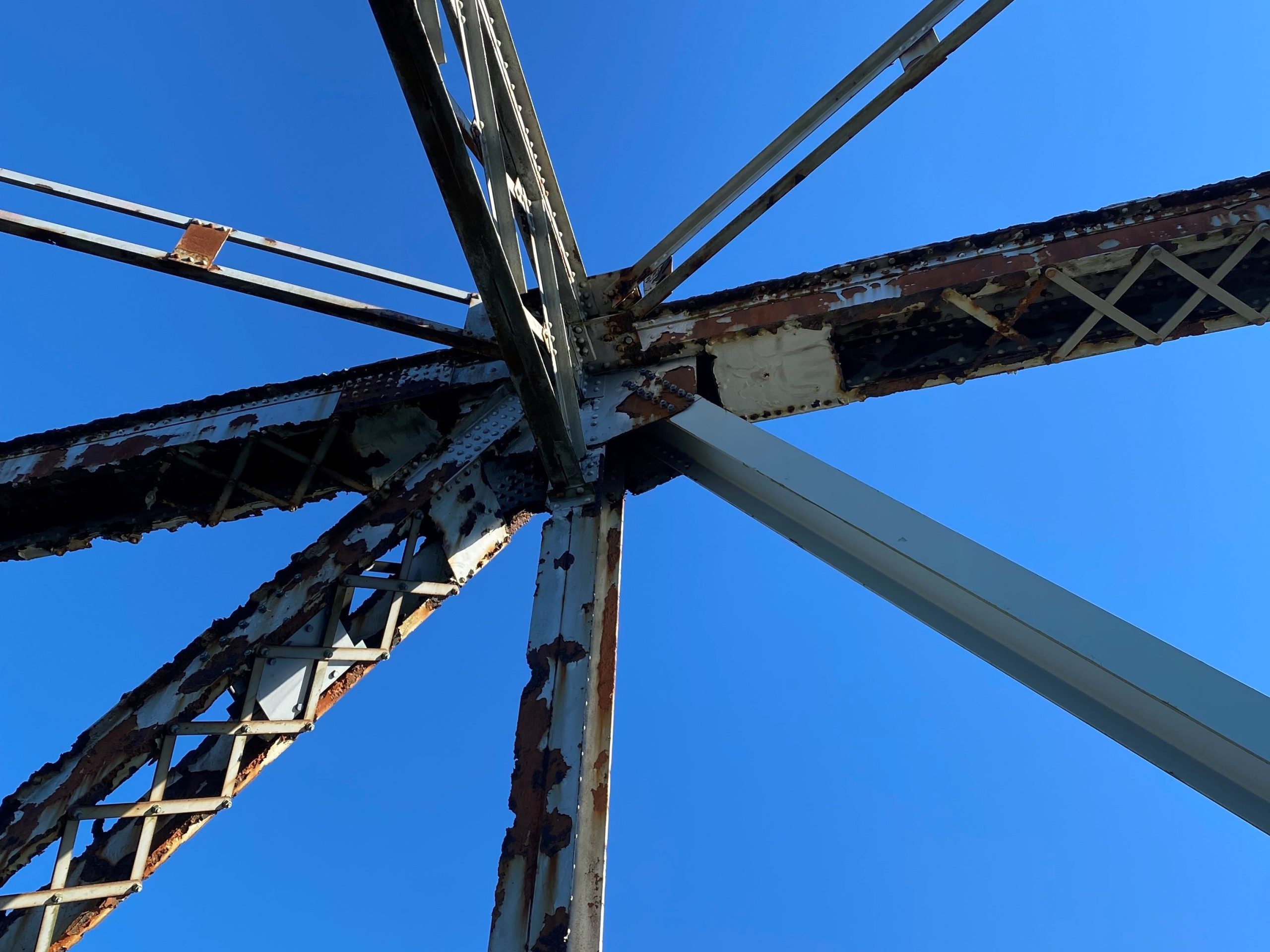 New diagonal member
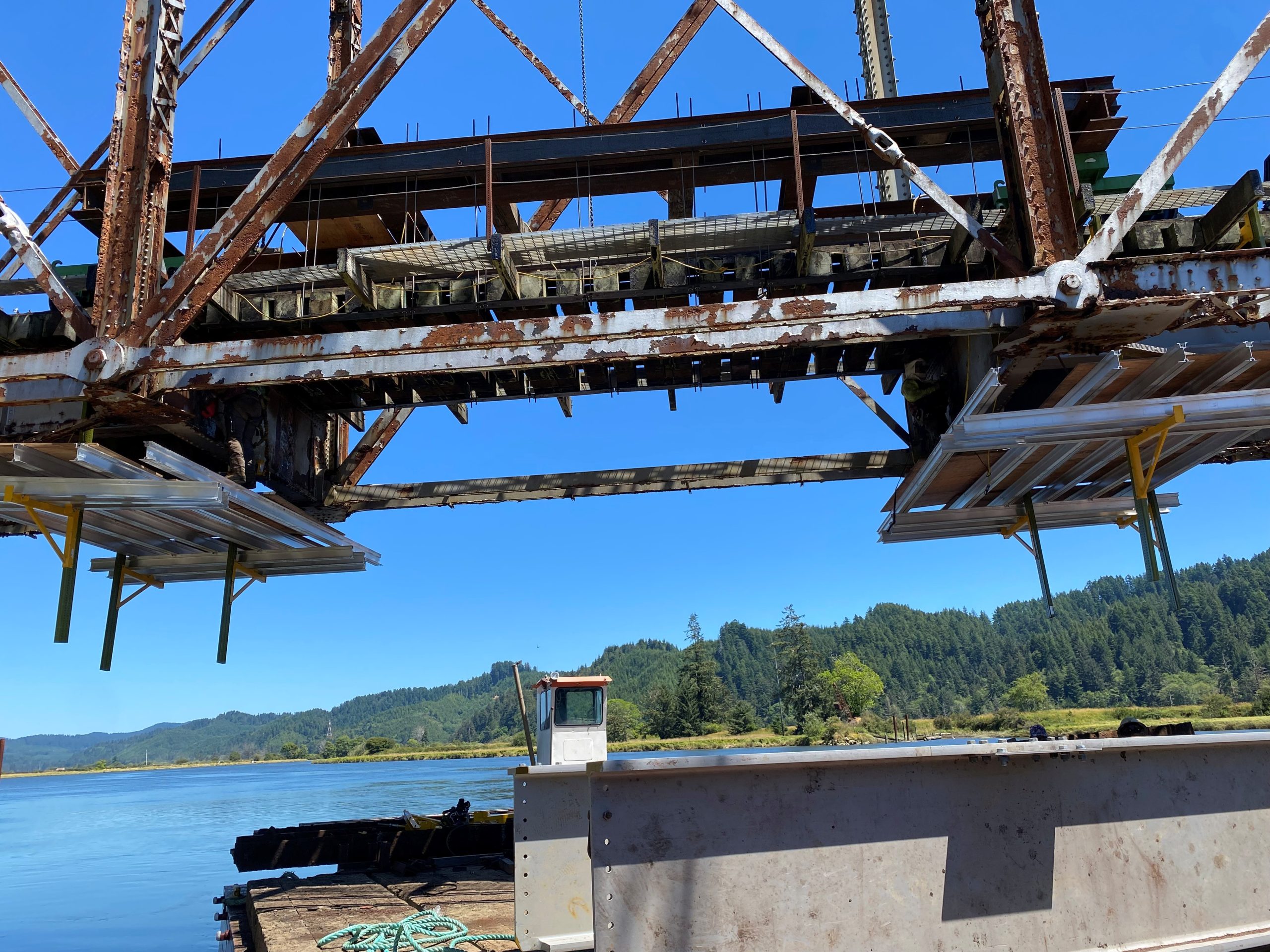 Replacing stringers on Siuslaw
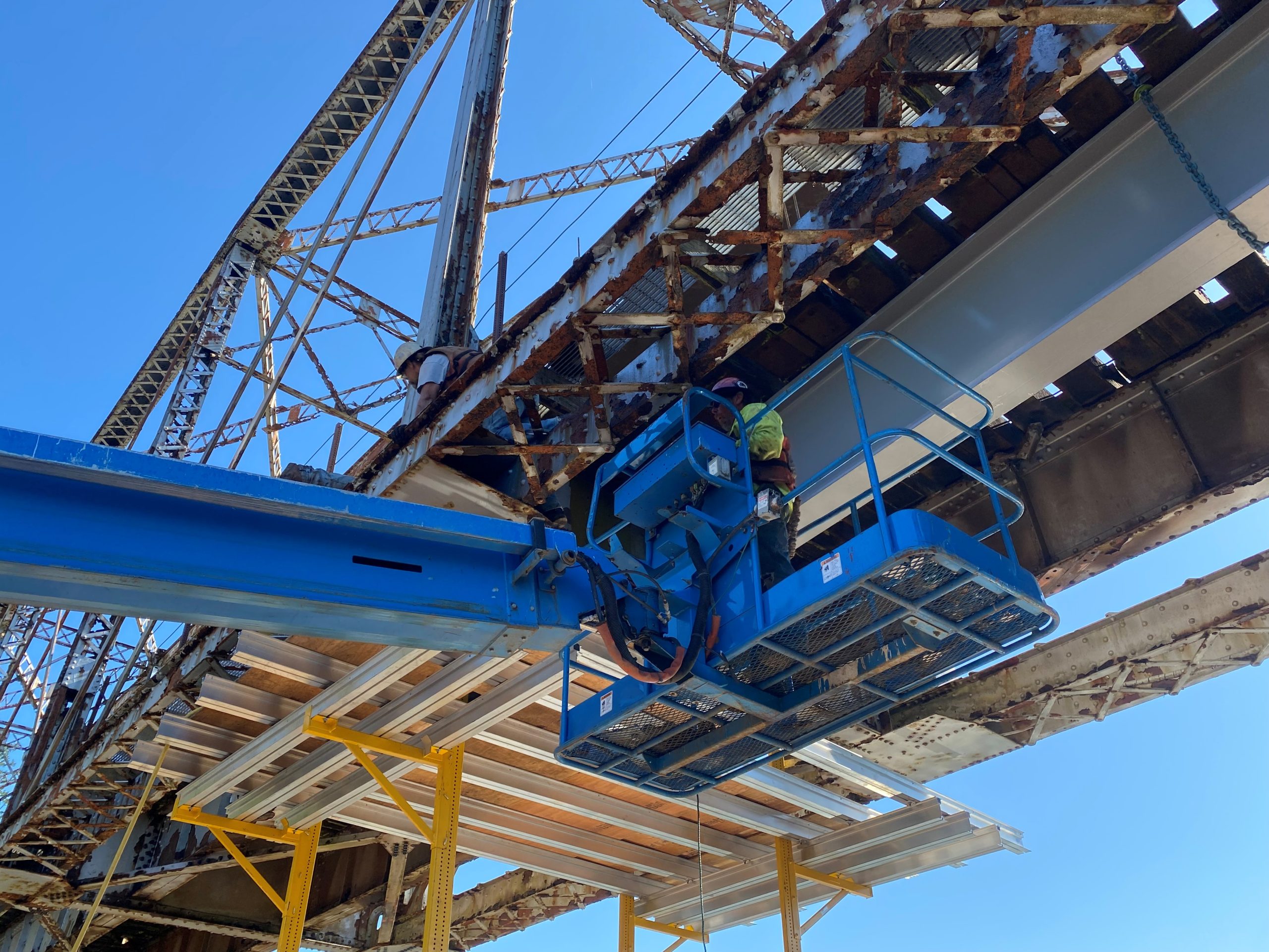 Installing new stringer
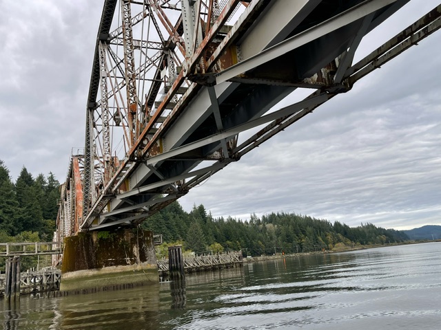 New stringers view from below
Point Cloud for Clash Detection
Process improvement project where the proposed modeled design is dropped into the a 3D point cloud.
Related content
Marine Industry - Point Cloud Meshes
Isolate scans of the lower hull and convert to a mesh for further use in Rhino3D by a Naval Architect. When modeling is not required, meshing scan data can save significant amounts of time. This is especially true with the challenges of modeling chines and strakes on fiberglass boats.
Related content
Port of Bellingham Building Restoration
As-Built building model and fly through using drone footage and Revit with 3D laser scans.
Related content
Laser Scanning Submersible Pumps - Laser scanning tanker ballast water treatment system and submersible pumps. Fitting pipe center lines from the scan data to complete an as-built pipe model for bwts.
Related content
Mesh CAD Models from 3D Laser Scans
Mesh models with CAD "snap to points" created from 3D Laser Scans. Mesh models are brought into your piping program where piping systems are routed and connected to provided tie-ins (snap to points). Convert your 3D laser scans into a mesh to save time and money on creating 3D models.
Related content
Creating Meshed CAD Models with Tie-Ins
Time normally spent modeling items such as new or existing equipment is eliminated by creating a mesh model from 3D laser scans. First the equipment in the registered point cloud is isolated from its surroundings. Next, the equipment is meshed and all critical tie-in points are created. The meshed equipment model is then brought into CAD and it's tie-ins connected to new or existing piping systems.
Related content
Coal Fired Boiler Project
3D laser scanning is used to support efficient planning for the removal of systems scheduled for demolition. This video briefly covers the demo process using 3D laser scanning combined with Kohera3D software technology. Systems in the pointcloud are isolated into separate layers allowing items to now be independently turned on or off. This provides focus and clarity to items of interest or when designers are trying to model inside a pointcloud consisting of millions of points. 3D scan data is used to reference tie in points. The boiler and connecting systems are added to the scan model and checked for clashes.
Related content
3D Laser Scanning above Drop Ceiling
Tight areas such as drop ceilings are cramped and difficult to access. Using the FARO 3D laser scanner, we were able to capture data and precise measurements of systems such as HVAC, piping, and other hard to reach systems and components. This was done in less time and at a fraction of the cost to the typical approach of evaluating MEP - where designers and/or engineers will go through and confirm drawings by eyeball from a distance, and crawl (often literally) through the suspended maze of piping, wiring, and duct work to measure and document existing MEP systems and their restraints. Read our article on Drop Ceilings and Seismic Retraints.
Related content
Laser Scanning an Underground Tunnel
200 scans taken and registered together. Point cloud was isolated and a fly through video created. Purpose of scanning was to record the position and condition of the concrete structure as well as the tunnel's current length. In the event of seismic shifts, the scan data will be used to analyze positional movement in the walls of this tunnel.
Installing Sulfur Reactor
Example of laser scanning technology for taking measurements. Superior and more precise than typical "old school" methods of using plumb bobs or measuring tapes.
Point Cloud Fly Through - Endeavour Ship and Dry Dock
Kohera3D isolation services combined with Summit Engineering and Design's Scan-To-Plan™. In this video we show a 3 way comparison of the registered point cloud, scan data isolation (layering), and the 3D model. Dry docking is an ideal time to have a ship's hull scanned for inspection, to create a docking plan, or to have other areas of interest scanned and recorded for use at a later time.
Related content