
Laser Scanning Tunnels and Bridges
3D Scanning Revolutionizes Bridge Restoration
We team up with Rainier Welding and Legacy Contracting to solve a complex bridge restoration project, combining 3D scanning technology with bridge building expertise.
How 3D Scanning Transformed the Process
- Eliminated Manual Templates: 3D scans replaced field-made templates, reducing human error.
- Captured Rivet & Bolt Patterns: Scans identified general rivet locations and structural variations in the original bridge. The precise dimensions and bolt patters required Kohera3D software and expert analysis, and lots of math!
- Created Digital Replicas: Using Scan-to-Plan™ technology, scan data is converted into highly accurate 3D models, ensuring fabricated components would fit precisely.
- Streamlined Fabrication: Rainier Welding, from 500 miles away, used the digital scan data to accurately detail and fabricate replacement components before arriving on-site, drastically reducing installation time. Parts could be painted and numerically identified, ready to install.
Read more on Rainer Welding's blog page

Replacing the X Brace on the North Bend bridge.

New plate installed on the Span 7, L6 member.

Diagonal repair on the North Bend bridge.

Crew replacing lacing bars on the bottom chords.
Laser scanning for bridge repairs, modifications, and dimension verification.
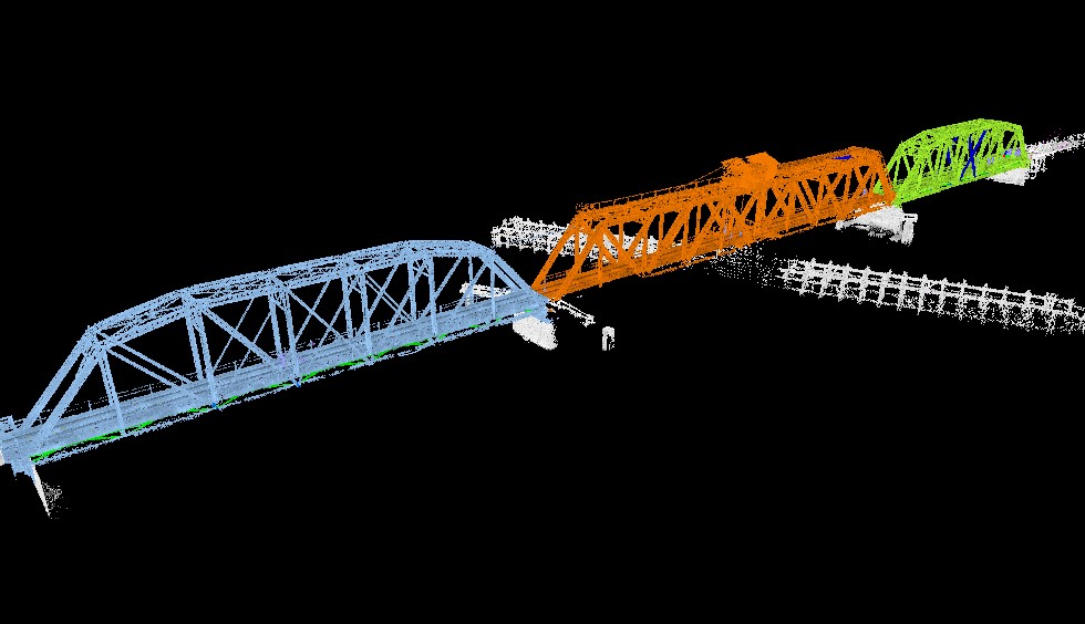
Zoomed out view of laser scanned bridge including the swing span.
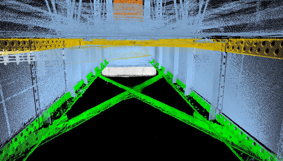
FARO laser scanner strategically positioned below stringers and lateral bracing to capture connection points and beam length, shape, and sizes.
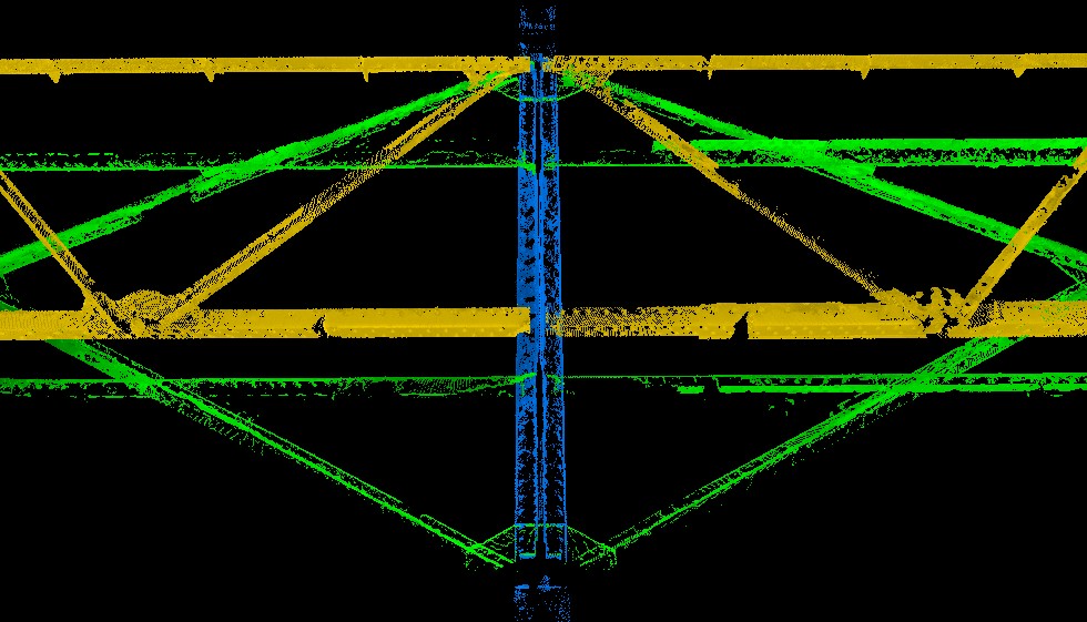
Items of interest isolated from surrounding data and place into relevant categories as seen by individually assigned colors.
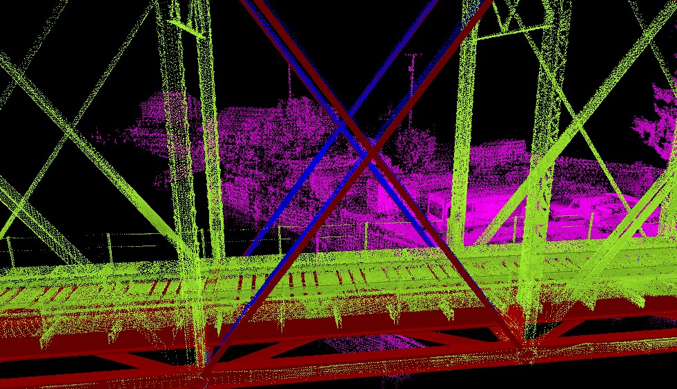
Detailer's bridge model placed inside the point cloud to verify location and dimensions of modeled components.
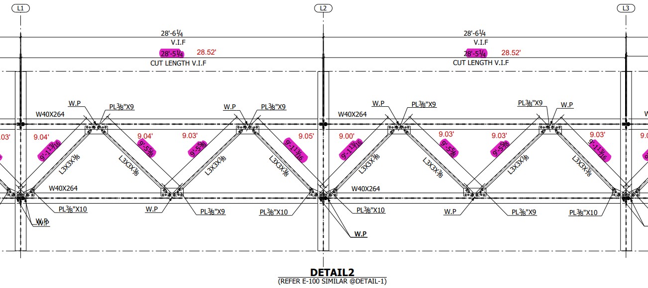
Bridge Repair Plan marked up with real life dimensions as captured by the laser scanner.
See also Nooksack River Bridge Repair
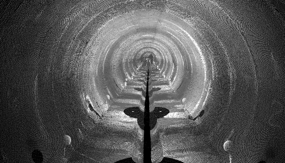
Laser scanning tunnels for deviation mapping.
Purpose of scanning was to record the position and condition of the concrete structure. In the event of seismic shifts, the scan data will be used to analyze positional movement in the walls of this tunnel.
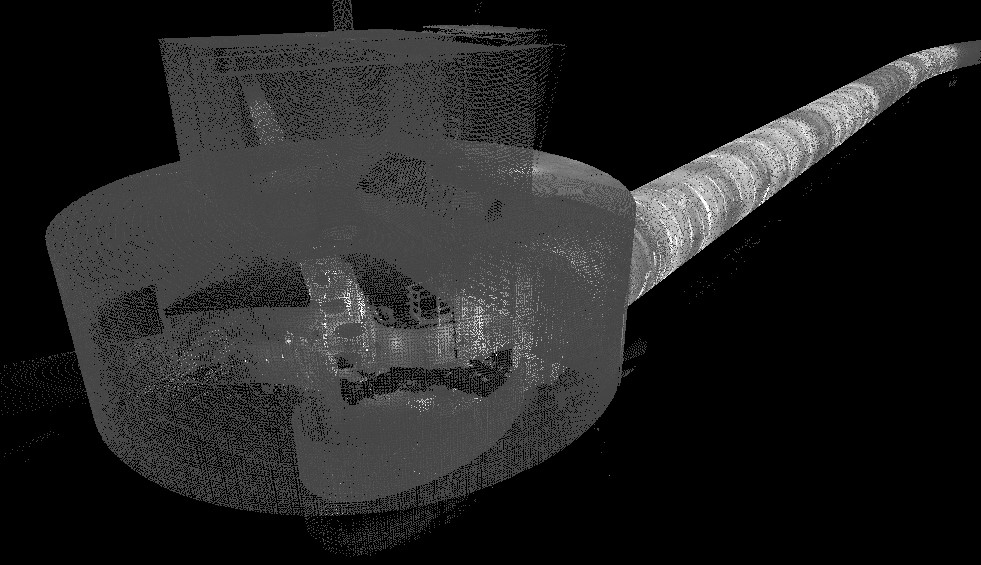
Scanning at the entrance of the underground tunnel.
Because of surface similarity in tunnel walls, the use of spheres are critical in scan registration.
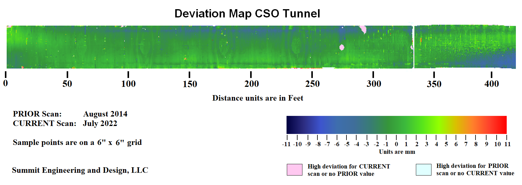
Deviation map using the first round of scanning performed in 2014 to a second round of scanning in 2022.
See also Tank Shell Deviation Map